Issued (1130 UTC) 730pm PhT 070814
________________________________
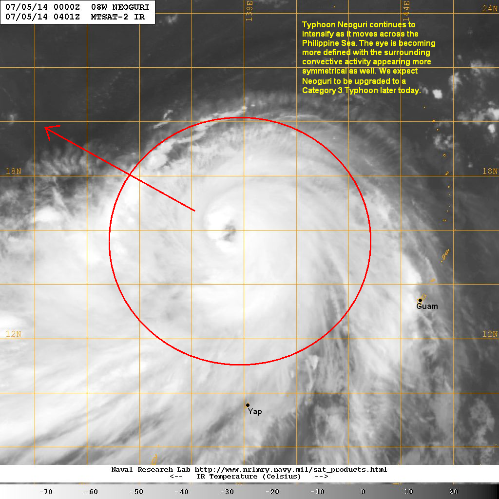
Typhoon Neoguri has weakened slightly as it moves across the East China Sea. The eye was last located approximately 260km northwest of Okinawa. Maximum sustained winds are down to 195kph with gusts of up to 240kph. Typhoon Neoguri is moving northward at 25kph.
IR Image from NRLMRY
Latest satellite image shows the eye of Neoguri remains intact although the convection is significantly weakening. Sea surface temperatures in the region are cooler and the increasing wind shear will help weaken Neoguri as it moves northward.
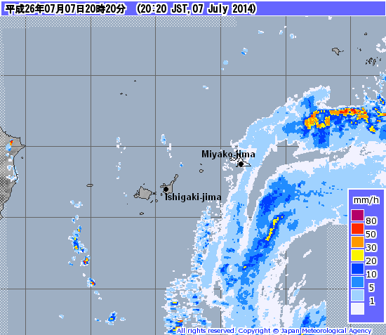
Radar Image from JMA
Typhoon Neoguri continues to affect the Ryukyu Islands with its bands of heavy rain moving across the region. Rainfall amounts of up to 200mm have already been recorded in some places and we will probably see another 100mm, especially across Okinawa, throughout the overnight hours. Winds of up to 140kph are also still lashing the islands but we expect these to diminish by the early morning hours of Wednesday.
For the latest radar image and warnings fro Japan, please click
HERE (JMA Website)
Forecast Track (NOT OFFICIAL!)
Typhoon Neoguri will continue moving northward tonight. Weather conditions across the Ryukyu Islands should begin to improve by tomorrow. The eye of Neoguri is forecast to make landfall in Kyushu by late evening tomorrow as a weakening Category 2 Typhoon. It will then track across Shikoku and pass south of Osaka by Thursday afternoon. By this time, it should weaken to a Tropical Storm. By Friday morning, Neoguri is forecast to pass near Tokyo.
Strong winds will not be the main threat for Mainland Japan (except Kyushu) but rather the widespread heavy rains that this typhoon will bring. We are expect up to 500mm to fall in some areas which could cause landslides and flash floods.
We'll have another update tomorrow morning.