____________________________
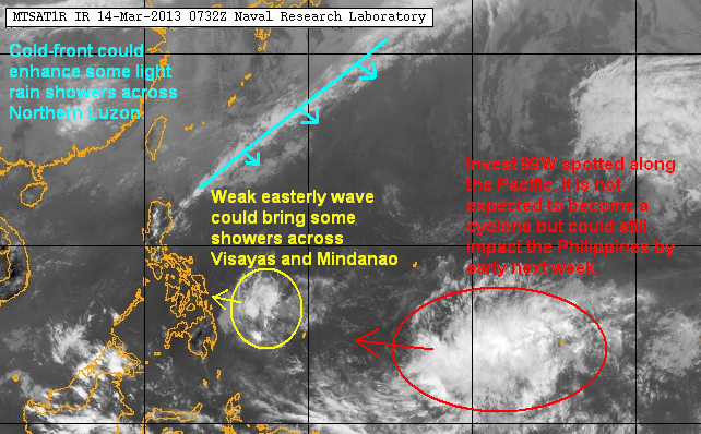
Temperatures continue to soar across the Philippines during this Holy Week. Many areas are reporting their hottest days so far this year and higher temperatures could be felt over the next few days. There is some respite, though, as rain showers are currently impacting Northern Luzon and could also be felt across Visayas and Mindanao.
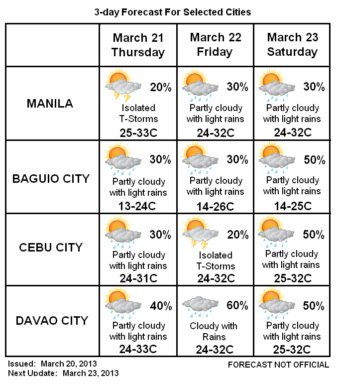
3-Day Forecast (NOT OFFICIAL!)

A series of fronts will be moving across Eastern China over the next 3 days. These fronts could enhance some precipitation across Northern and Eastern Luzon bringing the threat of scattered light rain showers. Rest of Luzon should have partly cloudy skies with temperatures climbing into the mid-30s during the afternoon. Due to the humidity and intense sun, the heat index (which is the temperature felt by the body) could be well into the upper-30s so please dress appropriately, don't stay out under the sun too long, and make sure to drink plenty of water.
Meanwhile, the easterlies will continue to bring scattered rains and thunderstorms across Visayas and Mindanao. The low pressure area that we've been watching this week--Invest 90W--isn't showing signs of development. However, it could still bring widespread rains across Mindanao early next week.
We'll have our next update on Monday, April 1. Happy Easter!