__________________________________
Maysak (Bagyong Chedeng) has now weakened to a Tropical Storm as it moves closer to the Philippines. The storm center was last located approximately 140km north of Virac, Catanduanes or about 340km east of Manila. Maximum sustained winds are down to 110kph with gusts of up to 140kph. TS Maysak is currently moving westward at 20kph.
As of 11pm this evening, PAGASA has raised Public Storm Warning Signal #3 for Isabela and Aurora.
Signal #2 for Northern Quezon, Polilio Island, Nueva Ecija, Southern Cagayan, Kalinga, Mt. Province, Ifugao, Benguet, Nueva Vizcaya, Quirino, and Catanduanes.
Signal #1 for Rest of Cagayan, Babuyan Island, Apayao, Ilocos Norte, Ilocos Sur, Abra, La Union, Pangasinan, Tarlac, Pampanga, Bulacan, Rizal, Rest of Quezon, Camarines Norte, and Camarines Sur.
IR Image from NRMRY
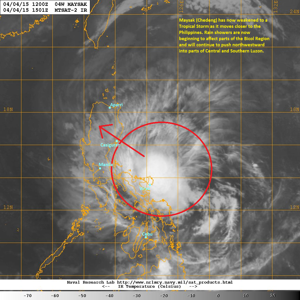
Latest satellite image shows Maysak becoming more elongated as it continues to suffer from strong shear in the region. Tropical Storm Maysak is also close enough that some of its rainbands are starting to affect parts of the Bicol Region particularly in Catanduanes and Camarines Provinces. We expect those light to moderate rains to continue through the morning hours.
Tropical Storm Maysak will continue moving northwestward and eventually make landfall near Casiguran, Aurora tomorrow morning. Widespread rains are expected across Central and Northern Luzon which can cause landslides and flash floods. Parts of Metro Manila may see some rain showers tomorrow as well. Maysak will exit Luzon tomorrow evening.
We'll have our next update tomorrow morning.
No comments:
Post a Comment