Issued (04 UTC) 12pm PhT 120514
_____________________________
Like our
FACEBOOK PAGE for the latest updates on this storm!
Hagupit (Bagyong Ruby) has weakened to a Category 4 Typhoon this morning as it undergoes an eyewall replacement cyclone over the Philippine Sea. The eye of Hagupit was last located approximately 420km east of Borongan, Eastern Samar. Maximum sustained winds are down to 230kph with gusts of up to 280kph. Typhoon Hagupit is moving west northwestward at 15kph.
As of 11am this morning, PAGASA has raised Public Storm Warning Signal #2 for Sorsogon, Ticao Island, Masbate, Northern Samar, Eastern Samar, Samar, Biliran, Leyte, Southern Leyte, Northern Cebu (including Cebu City), Bantayan Island, and Camotes Island.
Signal #1 is in effect for Catanduanes, Albay, Camarines Norte, Camarines Sur, Burias Island, Romblon, Capiz, Iloilo, Antique, Aklan, Negros Oriental, Negros Occidental, Rest of Cebu, Siquijor, Bohol, Surigao del Sur, Agusan del Norte, Dinagat Island, Siargao island, Misamis Oriental, Agusan del Sur, and Camiguin Island.
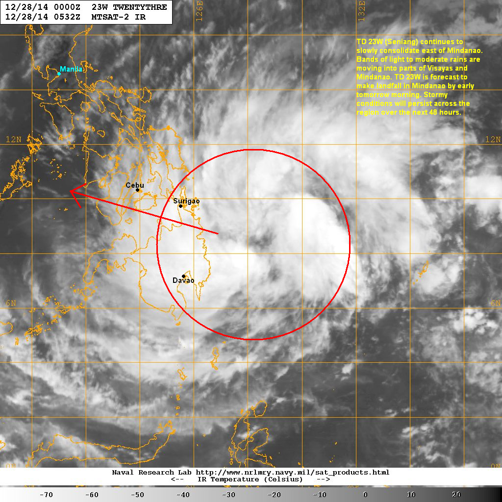
IR Image from NRLMRY
Latest satellite image shows the eye reforming as Typhoon Hagupit is undergoing an eyewall replacement cycle. This ERC has weakened the system from a Category 5 Super Typhoon down to Category 4 this morning. Upon the successful completion of the ERC, there is a small chance of a slight reintensification in the next 24 hours.
Forecast Track (NOT OFFICIAL!)
We have shifted our forecast track slightly northward as we see more agreement in the computer model outputs. Typhoon Hagupit is now tracking under a rebuilding Subtropical Ridge and should move generally westward over the next 24 hours. It is forecast to possibly make landfall in the island of Samar late Saturday evening or perhaps early Sunday morning as a strong Category 4 Typhoon.
Strong winds, heavy rains, and significant storm surge are highly likely along the coasts of Samar, Leyte, and even into the Bicol Region, particularly in the provinces of Sorsogon, Albay, and Catanduanes. Hagupit will weaken after landfall and will cross into the islands of Masbate, Romblon, and Mindoro. It will bring widespread rains across much of Visayas and into Southern Luzon, including Metro Manila, by Sunday and Monday. We expect Hagupit to exit into the South China Sea (West Philippine Sea) as a Category 1 Typhoon by Tuesday.
This is a very dangerous typhoon and the chances of landfall in the Philippines are high. We urge everyone along the path to prepare now and possibly think about evacuating. Even residents away from the path including those in Southern Luzon and Northern Mindanao should keep a close eye on the progress of Hagupit as the forecast track could still change. As always, please heed the warnings and instructions of your local officials!
We'll have another update later this afternoon. Stay safe!