________________________________
Like our FACEBOOK PAGE for the latest updates on this storm!
Tropical Depression 23W (Bagyong Seniang) has slightly intensified as it continues to consolidate east of Mindanao. The system was last located approximately 250km east northeast of Davao City. Maximum sustained winds are now at 55kph with gusts of up to 65kph. TD 23W is moving west northwestward at 15kph.
As of 11am this morning, PAGASA has raised Public Storm Warning Signal #1 for Southern Leyte, Bohol, Siquijor, Surigao del Norte, Surigao del Sur, Dinagat Province, Agusan del Norte, Agusan del Sur, Davao del Norte, Davao Oriental, Compostella Valley, Camiguin Island, Misamis Oriental, and Bukidnon.
IR Image from NRLMRY
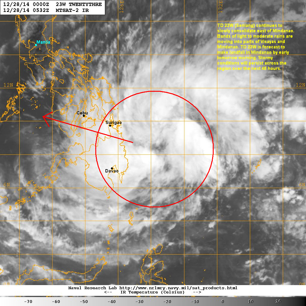
Latest satellite image shows convective activity continuing to build and become more organized. The low-level circulation continues to tighten as the system tries to consolidate just east of Mindanao. Bands of light to moderate rains have already been impacting parts of Visayas and Mindanao since last night. We expect up to 200mm of rain to fall in the next 24 hours increasing the likelihood of flash floods and landslides.
Forecast Track (NOT OFFICIAL!)

Tropical Depression Seniang will continue moving west northwestward and will likely make landfall in Surigao del Sur by early tomorrow morning. It will cross into Visayas and will bring widespread rains across the region over the next 2 to 3 days. Intensification will be limited due to land interaction. However, torrential rains will still bring dangerous weather conditions across many areas in Southern Philippines.
We'll have another update later tonight.
No comments:
Post a Comment