________________________________
Please LIKE our Facebook Page for the latest updates!
Typhoon Halong (Bagyong Jose) has maintained intensity as it tries to recover after undergoing an eyewall replacement cycle. The system was last located approximately 830km east of Basco, Batanes or about 680km south southeast of Okinawa. Maximum sustained winds are at 165kph with gusts of up to 205kph. Typhoon Halong is moving northward at 15kph.
IR Image from NRLMRY
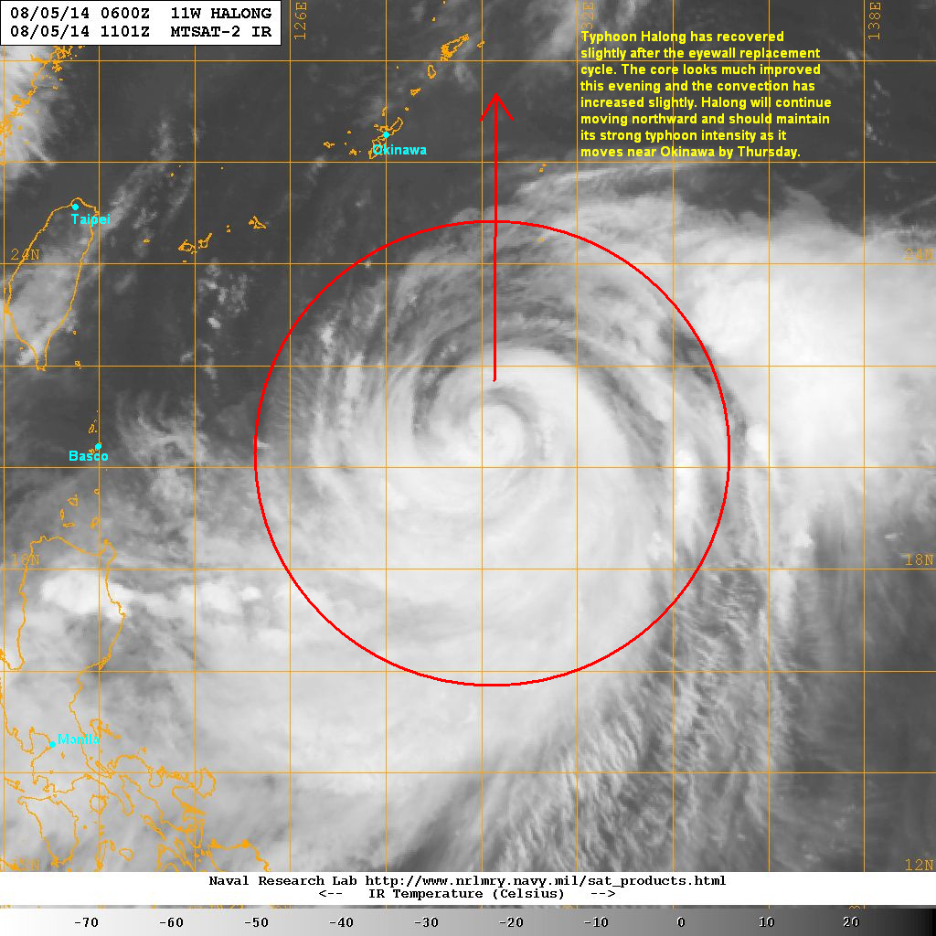
Latest satellite image shows the core of Halong has slightly improved this evening with tight banding wrapping around the center. Convection has also increased and become more symmetrical compared to this morning. Due to improved organization, Halong should be able to maintain its present intensity and could even slightly intensify by tomorrow.
Typhoon Halong will continue moving generally northward and could begin affecting the Ryukyu Islands by Thursday. It will pass between Okinawa and the Daito Islands and could bring strong winds and heavy rains in the region. The Daito Islands will see the worse conditions since they will be on the right side of the storm.
Later in the week, Halong is forecast to move into Mainland Japan possible affecting Kyushu and Shikoku and Friday as a strong Typhoon. Parts of Honshu could also be impacted over the weekend.
We'll have another update tomorrow.
No comments:
Post a Comment