____________________________
Please LIKE our Facebook Page for the latest updates!
Halong (Bagyong Jose) has weakened down to a Category 1 Typhoon this morning. The system was last located approximately 500km southeast of Okinawa. Maximum sustained winds are at 150kph with gusts of up to 185kph. Typhoon Halong is moving north northeastward at 15kph.
IR Image from NRLMRY
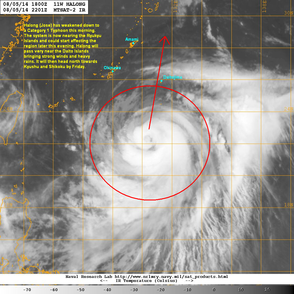
Latest satellite image shows the central dense overcast remains intact and symmetrical. Convective activity has slightly increased as well, and banding has improved especially on the northwestern quadrant. As Halong moves over warm waters, we might see slight re-intensification to occur over the next 24 hours.
Forecast Track (NOT OFFICIAL!)

Typhoon Halong will continue moving generally northward and could start affecting the Ryukyu Islands by this evening. Outer rain bands and strong winds will soon spread across Okinawa, Amami, and nearby islands by tomorrow. Daito Islands will bear the brunt of Halong and could see winds of up to 140kph and very heavy rain by tomorrow.
Halong will continue weakening as it tracks northward and could make landfall in Shikoku by Saturday morning. It will then cross Western Honshu and move into the Sea of Japan, weakening to a Tropical Storm by that time.
We'll have another update later today.
No comments:
Post a Comment