________________________________
Please LIKE our Facebook Page for the latest updates!
Tropical Storm Rammasun (Bagyong Glenda) has slightly intensified this morning as it races towards the Philippines. The storm center was last located approximately 700km east northeast of Borongan, Eastern Samar or about 800km east of Virac, Catanduanes. Maximum sustained winds are up slightly to 75kph with gusts of up to 95kph. TS Rammasun is moving westward at 30kph.
As of 5am this morning, PAGASA has issued Public Storm Warning Signal #1 for Camarines Norte, Camarines Sur, Catanduanes, Albay, Sorsogon, and Northern Samar.
IR Image from NLRMRY
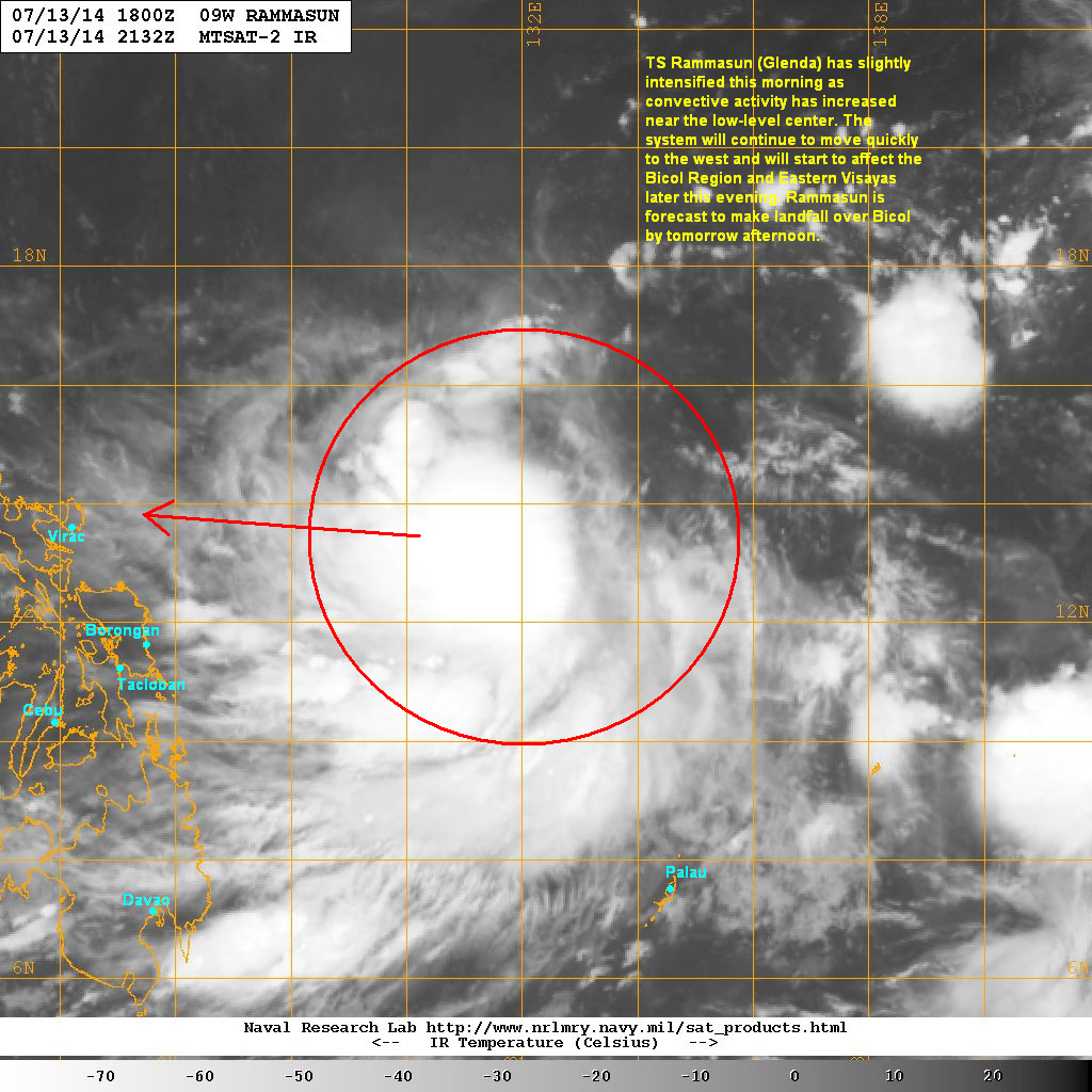
Latest satellite image shows that convective activity has increased over the past 6 hours with very cold cloud tops forming around the circulation. The low-level center also seems to have moved underneath the coldest cloud cluster which could mean that the system is further intensifying.
Forecast Track (NOT OFFICIAL!)

Tropical Storm Rammasun (Bagyong Glenda) will continue moving quickly to the west. It will start to impact parts of the Bicol Region and Eastern Visayas later this afternoon with light to moderate rains. The system should also continue slowly intensifying as conditions become more favorable.
Tropical Storm Rammasun is forecast to make landfall in the Bicol Region by tomorrow afternoon (Tuesday). There is a very small chance that Rammasun/Glenda will intensify to a Typhoon before it makes landfall. However, our current forecast track is not reflecting that at the moment. Of course, everything could change over the next 24 hours.
The biggest threat will be the widespread heavy rains that will spread towards Southern and Central Luzon, including Metro Manila. Flooding and landslides will be likely so please heed the warnings of your local officials!
We'll have another update this afternoon.
No comments:
Post a Comment