IR Image from NRLMRY
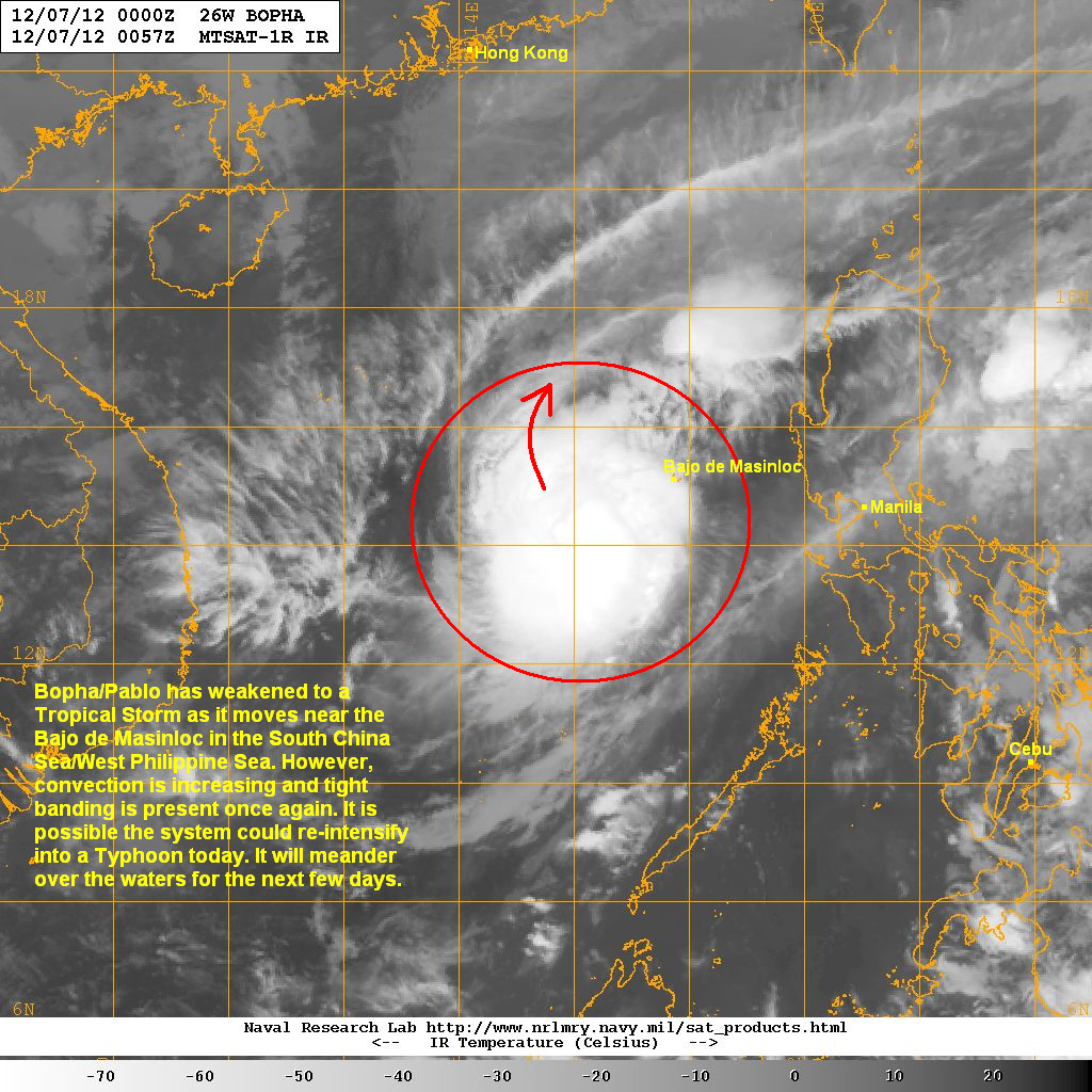
Despite the weakening overnight, we have seen an increase in convective activity over the last few hours. Furthermore, recent microwave images (not shown here) shows an eyewall has formed this morning. Due to this, we won't be surprised if Bopha get upgraded back to a Typhoon today.
Either way, the system should be much of a threat to the Philippines today and tomorrow. However, some computer models are showing a turn to the northeast, potentially towards Luzon by early next week. There are still some uncertainty to this solution though so there's not a lot of confidence with this forecast. Nevertheless, for the next two days, the Philippines should have generally clear weather with only small chances of light rains across Northern Luzon and parts of Eastern Visayas and Mindanao.
We'll have another update later this afternoon.
_______________________________________________
Issued (02 UTC) 10am PhT 120712
No comments:
Post a Comment