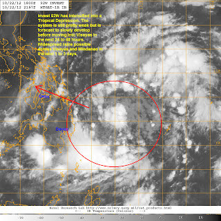
Invest 92W has intensified into a Tropical Depression. PAGASA has given the local name 'Bagyong Ofel' to this system as it is already inside the Philippine Area of Responsibility. TD Ofel was last located approximately 580km northeast of Davao City. Maximum sustained winds are at 45kph with gusts of up to 65kph. TD Ofel is moving west northwestward at 10kph.
IR Image from NRLMRY
Latest satellite image shows a pretty disorganized system with weak convective activity. Wind shear is still light and we still expect this system to slowly intensify over the next 2 days. TD Ofel is forecast to eventually move into Visayas by as early as tomorrow evening (Wednesday) as a Tropical Depression or a weak Tropical Storm. Widespread rains could begin affecting Eastern Mindanao and Visayas as early as today.
We'll have another update later this afternoon.
______________________________________________
Issued (2230 UTC) 630am PhT 102312

No comments:
Post a Comment