IR Image from NRLMRY
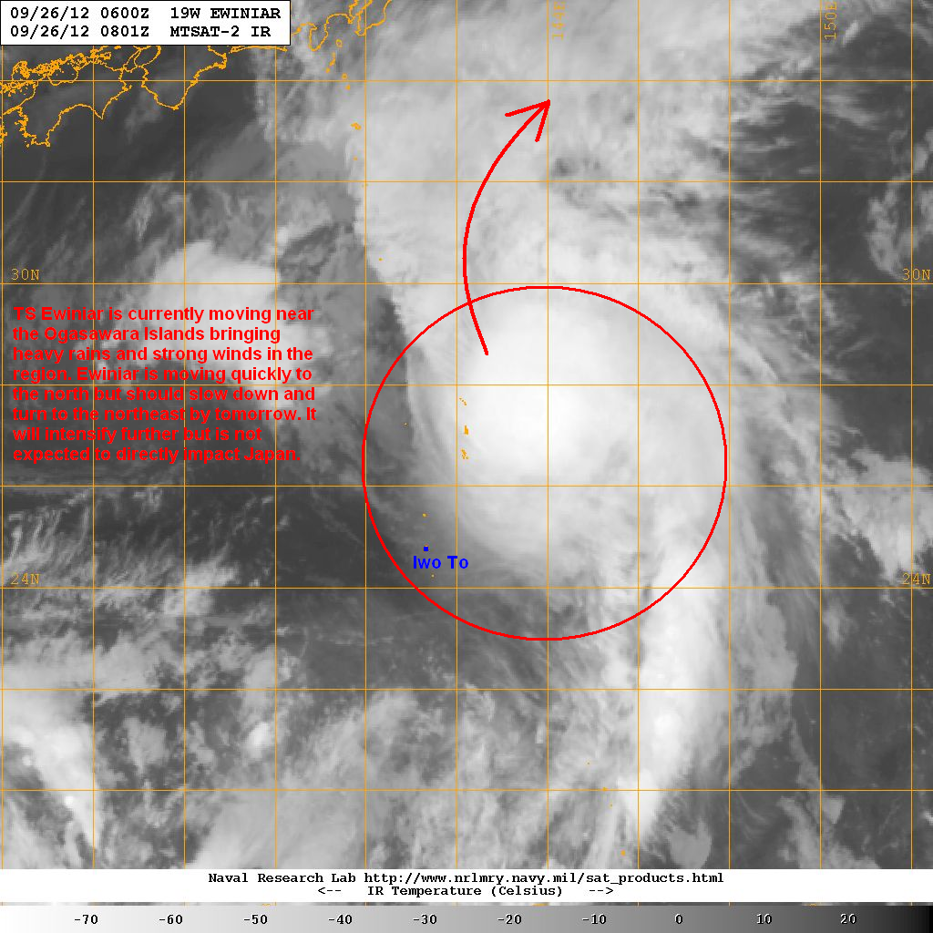
Latest infra-red image shows the convection is still partly displaced to the northeast and east of the low-level center. Wind shear remains moderate to strong and not allowing Ewiniar to really consolidate. The storm is currently moving near the Ogasawara Islands bringing strong winds of up to 80kph along with rainfall amounts of up to 100mm in the past 12 hours. We expect conditions in the islands to start improving by tonight as Ewiniar quickly heads northward.
Forecast Track (NOT OFFICIAL!)

Tropical Storm Ewiniar is currently moving northeastward but should turn more to the north tonight as it rounds the subtropical ridge that is located over the Northern Pacific. It will also slow down by tomorrow and could intensify further as we expect the shear in the region to weaken slightly. By Friday, Ewiniar could intensify to near typhoon-strength but by this time, the system is too far to really impact Honshu particularly Tokyo. We also expect the system to resume its northeastward course as a mid-latitude trough moves in from the west. By Saturday, Ewiniar is forecast to accelerate as it begins to interact with the jet stream and will be staying well east of Honshu and shouldn't really be a threat to the region.
We'll have another update tomorrow. Our complete Text and Video Update on Super Typhoon Jelawat will follow in about an hour.
____________________________________________
Issued (09 UTC) 5pm PhT 092612
No comments:
Post a Comment