IR Image from NOAA
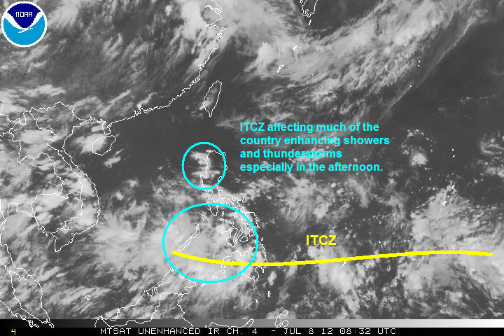
Latest satellite image shows clouds remain prevalent across the Philippines bringing rains across many parts of the country. The precipitation should be on and off and will not bring dangerous amounts of rainfall. However, Mindanao may experience heavier rains tonight and into tomorrow with amounts of 30 to 60mm possible. Rest of the country should also expect showers especially during the afternoon and early evening hours.
As was discussed in our last update, tropical cyclone activity remains quiet in the Western Pacific. The combination of the dry-phase of the MJO and the suppressed Kelvin Wave should discourage any cyclone formation in the next few days. Furthermore, computer models continue to show quiet weather this week with only scattered rains to really speak of. Barring any sudden tropical development, our next update will be on Wednesday.
________________________________________________
Issued (0930 UTC) 5pm PhT 070812
No comments:
Post a Comment