As of 5pm today, PAGASA has raised Signal #3 for Ilocos Sur, La Union, Benguet, and Pangasinan. Signal #2 for Ilocos Norte, Abra, Apayao, Kalinga, Mt. Province, Ifugao, Nueva Viscaya, Nueva Ecija, Tarlac, and Zambales. Signal #1 for Babuyan, Cagayan including Babuyan, and Calayan group of islands, Isabela, Quirino, Aurora, Bulacan, Pampanga, Bataan, and Metro Manila.
Rainfall reports so far range from 150 to 200mm in Central and Southern (Bicol) Luzon area. Reports of 100 to 150mm, on the other hand, in Northern Luzon Regions. Winds have died down, for the most part, over NCR and Eastern Luzon. We are still seeing some strong winds and heavy rain being reported across Western Luzon, particularly in Zambales and the Ilocos Region. These areas could still continue experiencing tropical storm-force winds and get 50 to 100mm of rain tonight. Conditions should begin to improve for much of Luzon tomorrow.
Weather conditions from PAGASA and WMO as of 3pm today.

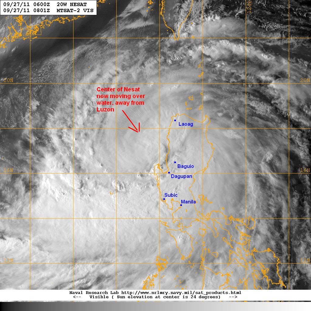
Latest VIS image shows the Central Dense Overcast (CDO) is now quickly exiting Luzon.There are still plenty of cloud cover though for much of Luzon. You can also see the inflow and the influence of the SW Monsoon affecting Visayas.
VIS Image from NRLMRY
The IR Image also showing the core has remained intact. Cloud tops have warmed and the storm has become fragmented as a result of land interaction with the Sierra Madre and Cordillera Mountains. The system also shows the convection still affecting Central and Southern Luzon with the SW Monsoon affecting Palawan, Visayas, and even Northern Mindanao.
IR Image from NRLMRY

TY Nesat will continue moving across the South China Sea and could regain intensity just below Cat 3 status. It will exit the PAR tomorrow and will pass well south of Hong Kong by Wednesday night. Computer models and forecasting agencies are bringing Nesat towards Hainan by early Friday as a Category 1 Typhoon.
Personal Forecast (NOT OFFICIAL)

We'll have another update tomorrow morning. Stay safe!
If you have any storm reports, please feel free share it with us.
________________________________________
Issued (0930 UTC) 530pm PhT 092711
No comments:
Post a Comment