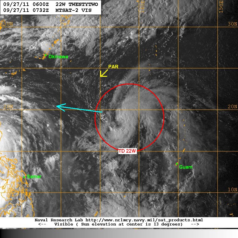
VIS Image shows the impressive organization of 22W with good banding, convection over the center, and excellent ouflow. It definitely looks good for a tropical depression.
VIS Image from NRLMRY
The accompanying Microwave image shows the banding that we mentioned above. There does seem to be sort of an eyewall beginning to take shape, particularly on the northeastern periphery.
MWI from NRLMRY

Conditions are favorable for continued development and we may actually see 22W be upgraded into a Tropical Storm later tonight. As I said though, the system is still too far from the PAR and we are not really expecting any direct effects until maybe this weekend. Among the computer models, ECMWF is the most aggressive in terms of development. The said models is taking 22W westward into either Taiwan or Northern Luzon. Please remember that we are talking maybe 4 to 5 days into the future. These forecasts can and do change.
We'll have another update tomorrow. Please refer to our separate posts for updates on TY Nesat and TD Haitang.
_______________________________________
Issued (09 UTC) 5pm PhT 092711
No comments:
Post a Comment