Tropical Storm Sonca continues to intensify as it begins to accelerate to the northwest. It was last located approximately 1,200km southeast of Tokyo. Maximum sustained winds are now at 110kph gusting to 140kph. Sonca is moving northwestward at 30kph. Sonca is now nearing typhoon status and could become one tomorrow morning.
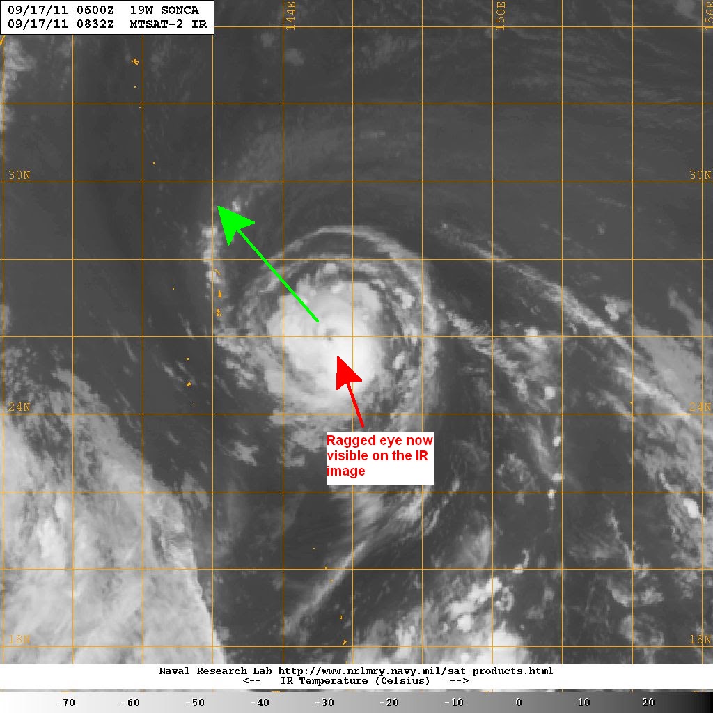
Latest IR image shows a ragged eye with convection mainly to the southeast. Microwave image also showing the continuous intensification with an eyewall clearly established now. Sea surface temperatures will still support intensification for at least another day. Wind shear remains weak to moderate (10 to 20kts).
IR Image from NRLMRY
Tropical Storm Sonca will continue moving northwestward, intensifying along the way. It could be upgraded into a typhoon tomorrow morning. Sonca will then begin turning to the northeast as it rounds the Subtropical Ridge. It will then accelerate as it passes east of Honshu on Monday. It is forecast to weaken slightly and become an extra-tropical cyclone as early as Tuesday. No rains and winds are expected for Japan due to Sonca. It will, however, bring strong waves and rip currents all along the Honshu Coast.
Personal Forecast (NOT OFFICIAL)

We'll have another update tomorrow.
_______________________________________
Issued (0930 UTC) 530pm PhT 091711
No comments:
Post a Comment