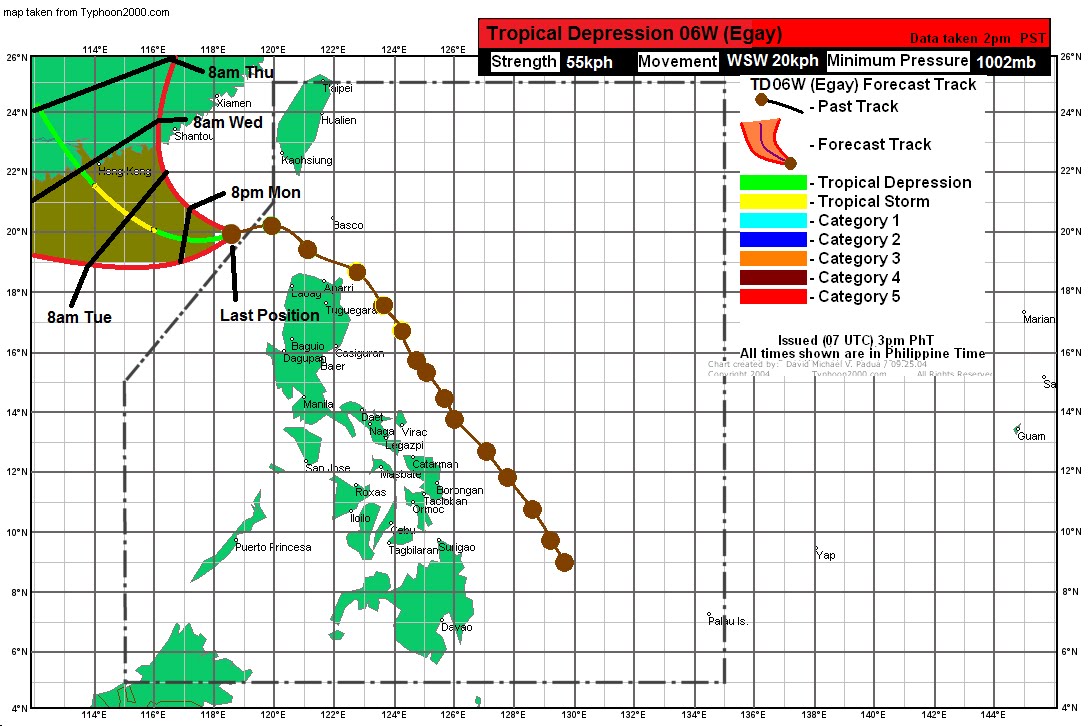
Convection has considerably decreased and the circulation center is barely visible on the satellite which suggest hampered development mainly because of moderate wind shear. Rain will continue, however, across Luzon. Rain reports continue to range from 50-150mm.
Our forecast has been shifted to the west and is now close to the consensus among computer models and the JTWC. There is a small window where TD 06W can re-intensify back into a tropical storm, perhaps tonight. It will quickly weaken back to a depression though before making landfall near or at Hong Kong by Wednesday morning.
Meanwhile, a developing low pressure has already entered the Philippine Area of Responsibility roughly an hour ago. It was last located about 380km NNW of Palau. Koror airport is reporting 30-40kph winds from the NW. Because of this, JTWC has put out a TCFA for a "good" chance of a storm developing within 24 hours. Latest computer models forecast this system to move through the Philippine Sea but not make direct impact to the country.
__________________________________
Issued (0730 UTC) 330pm PhT 062011
No comments:
Post a Comment