As of 11pm PhT Storm Signal Warning #2 is in effect for Cagayan, Babuyan, and Calayan. Signal #1 for Isabela, Quirino, Ifugao, Mt. Province, Kalinga, Apayao, and Batanes.
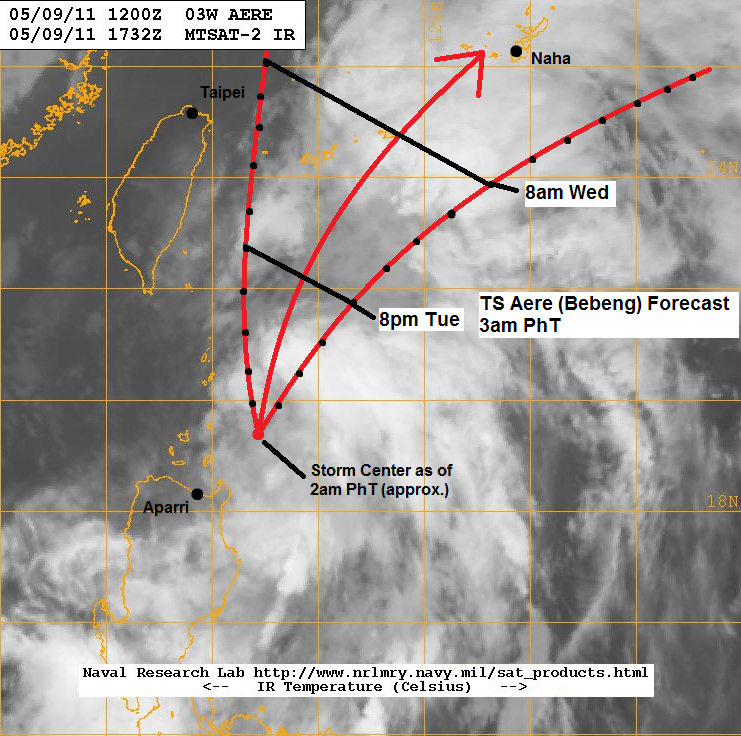
TS Aere is forecast to start turning to the northeast today. The recurving will depend on the strength of the Subtropical Ridge situated in the Pacific. Most models are in good agreement on the timing and so we are forecasting TS Aere to leave the Philippine Area of Responsibility as early as Wednesday. It is forecast to pass by Okinawa Wednesday night either as a weak Tropical Storm or a Tropical Depression. Aere should begin extratropical transition on Thursday.
PS: Remember when we said a tropical storm might form this week? The JTWC has issued a "Poor" confidence forecast for the Invest 94W. Computer models are starting to depict the said scenario. Whether it will track towards the Philippines is still too early to say.
 __________________________________
Issued (19 UTC) 3am PhT 051011
No comments:
Post a Comment