________________________________
Typhoon Pabuk has intensified further as it moves south of Japan. The eye of Pabuk was last located approximately 580km south of Tokyo. Maximum sustained winds are now up to 165kph with gusts of up to 205kph. Typhoon Pabuk is moving north northeastward at 20kph.
IR Image from NRLMRY
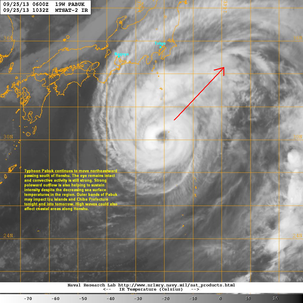
Latest satellite image shows the eye of Pabuk remaining uniform and well-defined. Convective activity is still strong in all quadrants. Poleward outflow remains excellent as well and that is sustaining Pabuk's strength despite the decrease in sea surface temperatures in this region.
Typhoon Pabuk should continue moving northeastward away from Japan. However, outer rain bands could still affect Izu Islands and southeastern Honshu including Chiba Prefecture. Gale force winds and high waves could also affect coastal regions along Honshu. Japan Meteorological Agency has issued advisories for those weather threats.
Pabuk should begin to weaken by tomorrow as sea surface temperatures in the Northern Pacific could no longer sustain strong tropical cyclones. Pabuk should also begin extra-tropical transition tomorrow as it nears the baroclinic zone and begins to encounter cool and dry air.
We'll have another update tomorrow.
No comments:
Post a Comment