IR Image from NRLMRY
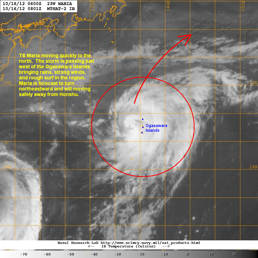
Latest satellite image shows the system improving in structure over the past 24 hours. TS Maria looks more symmetrical with ample convective activity. Heavy rains continue to fall across the Ogasawara Islands with stations now reporting 30mm of rain in the past 6 hours. 30 to 50mm of rain are still possible in the next few hours. Furthermore, winds of up to 60kph are being reported in the islands. A gust of 100kph was also reported in Iwo To as Maria moved near the airport there earlier this morning.
Forecast Track (NOT OFFICIAL!)

Since Maria is moving northward at a quick pace, we expect conditions in the Ogasawara Islands to get better tonight and into tomorrow. Maria is forecast to turn northeastward by tomorrow and will be passing well south of Honshu. The storm will then accelerate as it encounters stronger westerly winds in the Northern Pacific and could become an extra-tropical storm by Friday.
We'll have another update on Maria tomorrow. Complete Text and Video Update for Prapiroon will be up in about an hour.
______________________________________________
Issued (0830 UTC) 430pm PhT 101612
No comments:
Post a Comment