**If you have your own videos or images from the system, please share them to us at philippineweather@yahoo.com
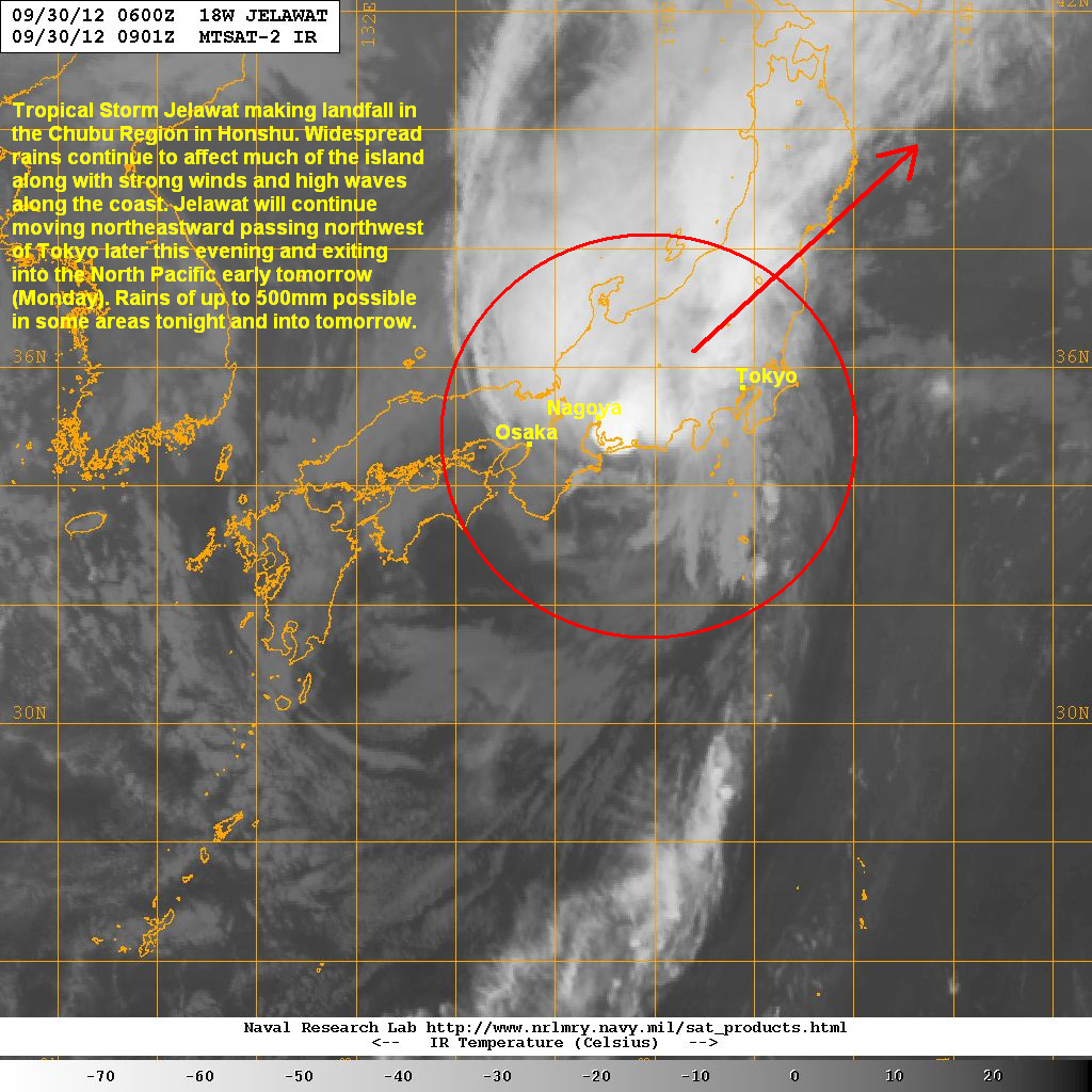
Jelawat has now weakened to a Tropical Storm as it makes landfall in Honshu. Tropical Storm Jelawat (Formerly Bagyong Lawin) was last located approximatel 280km west southwest of Tokyo. The system is currently moving through the prefectures of Mie and Aichi in the Kansai (Kinki) and Chubu Regions. Maximum sustained winds have weakened to 110kph with gusts of up to 150kph. Jelawat is moving northeastward at 45kph.
IR Image from NRLMRY
Latest satellite image still shows some convective activity especially along the northern side of Jelawat's circulation. The southern half, however, has very little convection due to the dry air from the northwest that is slowly wrapping around the circulation. Furthermore, strong upper-level winds in this region is starting to shear Jelawat and is also helping increase the coverage of the rains associated with the system.
Radar from JMA

Latest radar from JMA shows the widespread moderate to heavy rains currently falling across many parts in Honshu. Some of these bands contain pockets of really heavy rain that can drop as much as 80mm in an hour! Meanwhile, the wind reports in the region have ranged from 80 to 100kph with some stations reporting gusts of up to 150kph. Jelawat, may be weakening at this point but this system is still a dangerous storm!
For the latest radar images, as well as warnings and forecasts for Japan, please visit the Japan Meteorological Agency by clicking HERE
Forecast Track (NOT OFFICIAL!)

Tropical Storm Jelawat will continue moving quickly northeastward. It will past around 150km northwest of Tokyo later this evening bringing gusty winds and heavy rains in the metro area as well. Jelawat will move across the regions of Chubu, Kanto, and Tohoku throughout tonight. Jelawat is forecast to exit into the North Pacific by early tomorrow morning (Monday) and will be staying south of Hokkaido and the Kuril Islands as it transitions into an extra-tropical cyclone.
TROPICAL UPDATE
Meanwhile, we're watching two low pressure areas that could become Tropical Storms in the next 5 days. One is near Guam and the other is in the South China Sea. Watch our video above for more details on these two systems.
We'll have another update on Jelawat and the Tropics tomorrow. Stay safe!
_____________________________________________
Issued (0930 UTC) 530pm PhT 093012
No comments:
Post a Comment