Red Warning remains in effect in China as both Saola and Damrey make their way across the country. Please continue monitoring the developments especially within Fujian, Jiangsu, and Shandong Provinces.
CWB Radar (Click HERE for more warnings and forecasts from China)

Radar image out of Fuzhou shows the moving inland with the bulk of rains now over much of Fujian Province. Fuzhou has also been reporting winds of 30 to 40kph with light to moderate rains for the past 3 hours. Rains and winds will continue across the region throughout the day. Rainfall amounts of up to 200mm are also possible in this area, although some higher areas could see more than 300mm just like what we saw in Taiwan. There, some stations in the Central Region reported nearly 800mm of rain in just 24 hours. Unfortunately rains and winds in Taiwan also killed 6 people based on the reports so far.
IR Image from NRLMRY
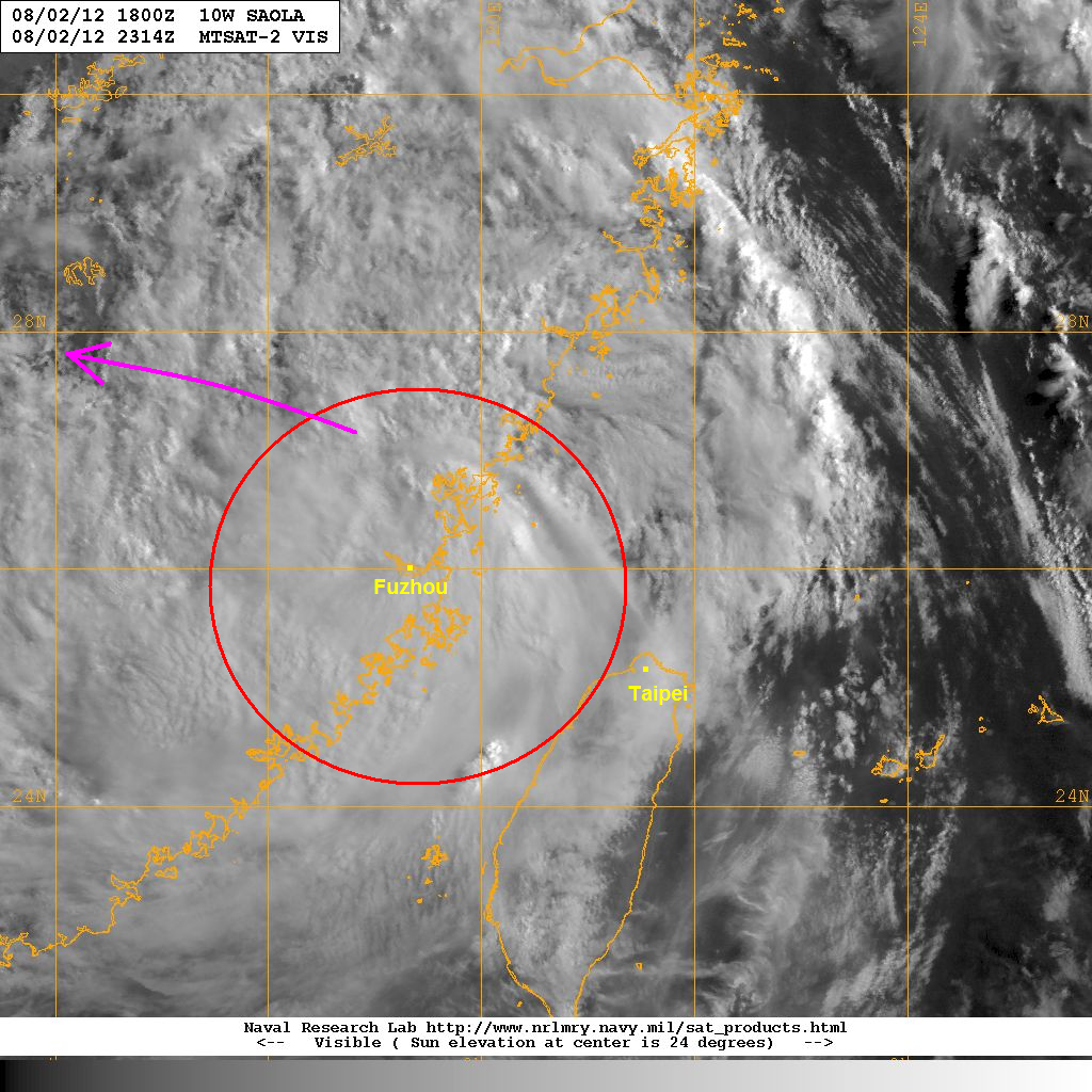
Latest satellite image shows much of the clouds now moving into China. There are still some light rains across Northern and Western Taiwan although conditions there should start to improve today. Saola will continue rapidly weakening today as it tracks further inland. It will continue to bring widespread rains across Southeastern China as it dissipates as a depression later tonight.
We'll have another update later today.
_______________________________________________
Issued (00 UTC) 8am PhT 080312
No comments:
Post a Comment