Tropical Storm Kai-Tak (Bagyong Helen) is starting to head back out to sea after making landfall in Cagayan earlier today. The system was last located approximately 20km east of Aparri. Maximum sustained winds remain at 100kph with gusts of up to 130kph. Kai-Tak is currently moving north northwestward at 20kph.
No changes in the Public Storm Warning Signals by PAGASA; please read our earlier update for the complete list of provinces under a warning signal (from 5am).
VIS Image from NRLMRY
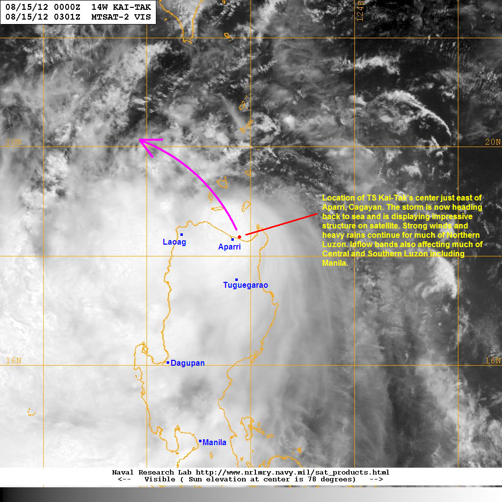
Latest Visible Satellite image shows the Central Dense Overcast (CDO) of Kai-Tak starting to move into Luzon Strait. Reports from Cagayan and Ilocos Norte all confirm the proximity of the center of the storm. Furthermore, rainfall reports in the region are already starting to rack up with many stations reporting 100mm with some places even picking up as much as 200mm in the past 24 hours.
Kai-Tak will continue moving to the northwest away from Northern Luzon but the stormy conditions will likely persist through tomorrow. Flooding and landslides are likely along the regions of Northern Luzon (Cordillera, Benguet, etc) so please listen to the news and your local officials. As for the south, Kai-Tak is starting to tap into the Southwest Monsoon (Hanging Habagat) so rains will continue here as well, including gusty winds. In fact, Manila Airport is reporting winds of up to 40kph along with light rains. You can go to PAGASA's Project NOAH for the latest radar images as well as rainfall forecasts.
We'll have our complete update as well as forecasts for Kai-Tak later today. If you have any storm reports, images, videos, or just questions, please email them to us at philippineweather@yahoo.com
_______________________________________________
Issued (0330 UTC) 1130am PhT 081512
No comments:
Post a Comment