IR Image from NOAA
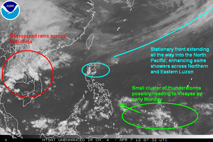
As for the Philippines, it remains mostly clear except for Northern and Eastern Luzon. A stationary front extending all the way into the Northern Pacific is enhancing some thunderstorms in the said areas. There have been no reports of heavy rain, fortunately. However, do expect showers to continue for the next 2 days. Central and Southern Luzon will have partly cloudy skies with only a low chance for an afternoon thunderstorms. Clear skies will also help temperature to rise dramatically during midday hours. PAGASA is not ruling out the possibility of 35-degree (C) weather, especially in Manila, during the next few days. Combine that with high humidity and the heat index could very well jump into 38C (100F) so please be careful when heading out into the sun!
Forecast Graphic, NOT OFFICIAL!

Visayas and Mindanao are also enjoying abundant sunshine. There are some thunderstorms seen on the satellite for Southern and Western Mindanao althought these showers should be short-lived and fast moving. However, higher chances for rain could return by Monday. A small cluster of thunderstorms currently in Western Micronesia is forecast to move westward and affect Visayas and Mindanao early next week. These thunderstorms are not that widespread although can still drop 30 to 50mm in 24 hours. Weather should improve later on Tuesday.
Next update on Tuesday, April 10.
_______________________________________
Issued (09 UTC) 5pm PhT 040712
No comments:
Post a Comment