Latest IR image shows that the low level circulation that was fully exposed this morning has begun to be cloud covered again as a new cluster of convection forms over the center. Cold cloud tops continue to form closer to the circulation which might indicate weaker wind shear. However, this batch of storms is still displaced somewhat northwest of the center; combined with the fast forward speed of 27W, we might see a slow rate of intensification for at least 12 to 24 hours.
IR Image from NRLMRY

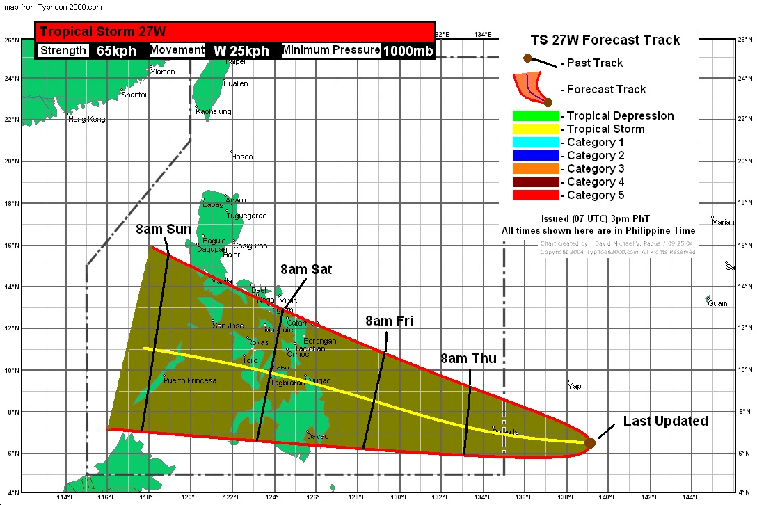
TS 27W is forecast to move close to Palau later tonight which is why a Tropical Storm Warning is now in effect for Palau and a TS Watch for Yap. Expect winds to increase in the coming hours, combined with widespread light to moderate rains. Rainfall amounts could vary from 100 to as much as 200mm in 24 hours. There will also be increased surf as the storm approaches. Conditions should improve by tomorrow afternoon.
TS 27W will then continue moving westward and could be inside the Philippine Area of Responsibility by tomorrow morning. Due to the conditions remaining favorable throughout the forecast period, TS 27W should intensify further before impacting the Philippines. Timeline for TS 27W would be around Friday morning for Northern Mindanao. It will then cross into Central Visayas and exit into Palawan by Saturday. JTWC is forecasting this to become a typhoon, we're not. However, that could change.
Personal Forecast
We'll have more updates by tomorrow.
_______________________________________
Issued (09 UTC) 5pm PhT 121411
No comments:
Post a Comment