Latest satellite images of Sonca now showing improved banding and structure. However, we have seen a continuous warming of cloud tops over the past 6 hours which could signify a weakening trend. This remains to be seen, however; the environment is still somewhat favorable for mild intensification so we will have to see.
The good news is that Sonca is not really expected to affect any land mass. It is forecast to continue moving west northwestward under the influence of the Subtropical Ridge to the north. As that ridge weakens and moves east, this will leave an opening and that will make Sonca recurve AWAY from Japan. Computer models and forecasting agencies are in very good agreement with regard to this scenario.
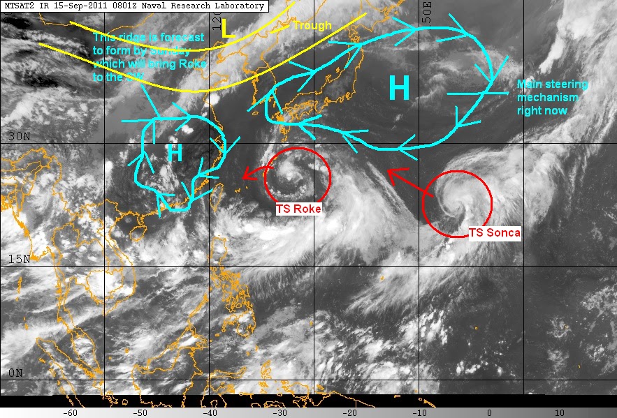
IR image from NRLMRY ("drawings" added by me)
Personal Forecast (NOT OFFICIAL)

For updates on TS Roke, please consult our other post. We'll have another update tomorrow.
______________________________________
Issued (0930 UTC) 530pm PhT 091511
No comments:
Post a Comment