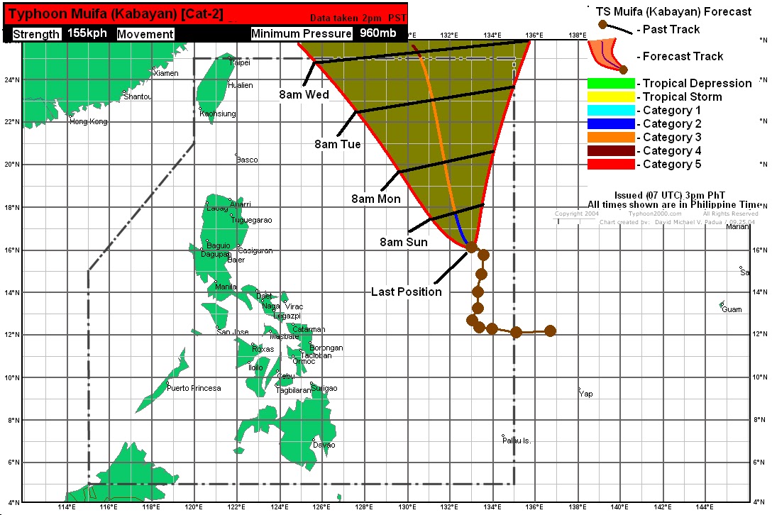
The recent westward movement is considered a wobble and won't significantly change the forecasts. However, the rapid intensification is well above the guidance by models and weather agencies. This could mean that, if favorable conditions persist, we could see Muifa become a major typhoon in the next 3 days, if not a super typhoon.
Latest forecast tracks from computer models still show significant divergence. The disparity, however, is lessening as the models continue to resolve the impact of the STR. Looking at the consensus, it seems the area just north of Taiwan all the way to the Ryukyus is the likely destination by Muifa. Our forecast shows the storm moving northward and exiting the Philippine Area of Responsibility by as early as Tuesday. It will then start turning westward towards the Okinawa area, hitting the Japanese Islands by Wednesday night or Thursday as a strong Category 4.
Our video update is coming up in less than an hour!
_______________________________________
Issued (08 UTC) 4pm PhT 073011
No comments:
Post a Comment