________________________________
Please LIKE our Facebook Page for the latest updates!
Typhoon Halong has maintained intensity as it slowly tracks northward. The system was last located approximately 370km east northeast of Okinawa. Maximum sustained winds are at 150kph with gusts of up to 185kph. Typhoon Halong is moving northward at 10kph.
IR Image from NRLMRY
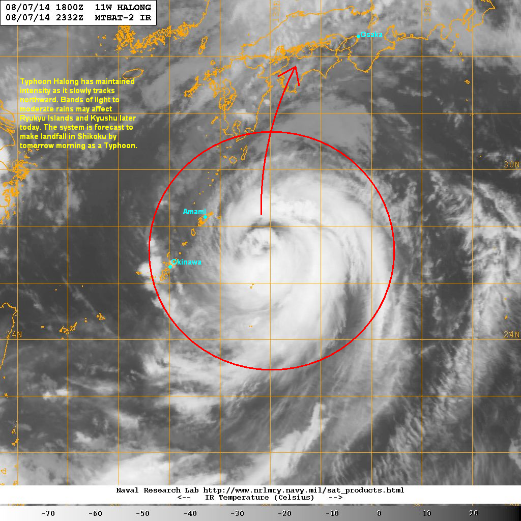
Latest satellite image shows little change with the organization of Halong. The western portions are starting to erode due to increasing shear and dry air. However, the eye is still visible and convective activity is still strong and abundant. There is also good radial outflow helping Halong to maintain that strong typhoon intensity.
Forecast Track (NOT OFFICIAL!)

Bands of light to moderate rains may start impacting Amami and Ryukyu Islands later this morning. Kyushu Island will also start to see stormy conditions later this afternoon. Eastern coast of Kyushu, including the city of Miyazaki will see the strongest winds of up to 100kph along with periods of heavy rain. The coast should also get pounded with high waves over the next 12 to 24 hours.
Halong is forecast to make landfall in southwestern Shikoku by Saturday morning as a Category 1 Typhoon. It will then weaken to a Tropical Storm as it tracks into Western Honshu and then exit into the Sea of Japan by Sunday. The regions of Shikoku, Chugoku, and Kinki will feel the stormy conditions over the weekend.
We'll have another update later today.
No comments:
Post a Comment