_______________________________
Please LIKE our Facebook Page for the latest updates!
Tropical Storm Halong has slightly weakened as it struggles with strong upper-level winds. The system was last located approximately 340km northwest of Guam or about 380km east of Saipan. Maximum sustained winds are at 85kph with gusts of up to 110kph. TS Halong is moving west northwestward at 15kph.
IR Image from NOAA
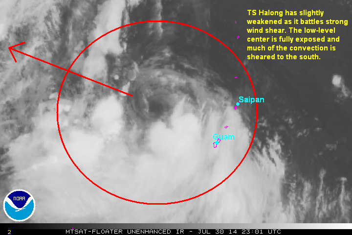
Latest satellite image shows the low-level center of Halong has been fully exposed as the system battles strong upper-level winds. Much of the strong convective activity is being relegated to the southern half of the circulation. We expect the wind shear to relax in the next few days which should allow Halong to resume intensifying.
Forecast Track (NOT OFFICIAL!)

Tropical Storm Halong will continue moving west northwestward over the next few days and should resume intensifying as environmental conditions become more favorable for development. Long-range forecasts show Halong intensifying perhaps into a Category 2 Typhoon by early next week. It could also pose a threat to the Japanese Islands in the next 3 to 5 days.
We'll have another update later today.
No comments:
Post a Comment