_________________________________
Typhoon Utor (Bagyong Labuyo) is now beginning to move into the South China Sea (West Philippine Sea) after making landfall in Aurora earlier this morning. The center of Utor was last located approximately 30km northwest of Baguio City, 60km north of Dagupan City, or about 230km north northwest of Manila. Maximum sustained winds are at 165kph with gusts of up to 205kph. Typhoon Utor is currently moving west northwestward at 25kph.
As of 11am this morning, here are the latest Signal Warnings issued by PAGASA:
Signal #3: Quirino, Nueva Vizcaya, Ifugao, Mt. Province, Ilocos Sur, Benguet, La Union , and Pangasinan.
Signal #2: Isabela, Aurora, Southern Cagayan, Kalinga, Abra, Southern Ilocos Norte, Zambales, Tarlac, and Nueva Ecija.
Signal #1: Rest of Cagayan, Apayao, Rest of Ilocos Norte, Babuyan Group, Calayan Group, Pampanga, Bulacan, Bataan, Rizal, Northern Quezon , Polillo Island, and Metro Manila.
Areas under Signal #3 will continue to have typhoon winds of up to 160kph for the next 3 to 6 hours. Signal #2 should continue to experience tropical storm winds of up to 100kph over the next 6 hours while Signal #1 areas will have winds of around 60kph. Many areas mentioned here should also continue to expect widespread moderate to even heavy rains capable of dropping 100 to 200mm of rain.
IR Image from FNMOC
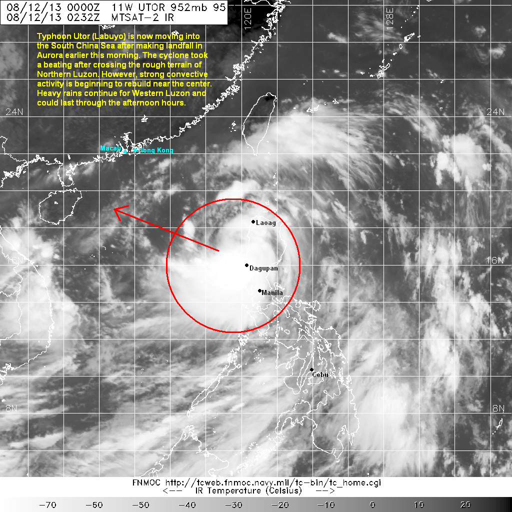
Latest satellite image shows the central dense overcast of Utor took a beating and looks somewhat disorganized as it crossed the mountainous terrain of Northern Luzon. Nevertheless, we are starting to see strong convective activity beginning to rebuild on the western side of the Utor's circulation; suggesting that the circulation may be entering the waters of South China Sea.
Radar Image from Subic

Much of Western Luzon, especially La Union, Pangasinan, Zambales, Tarlac, Pampanga, and Bulacan will continue to have widespread light to moderate rains. As much as 200mm of rain has already been recorded in these areas and another 100mm is possible today. Flooding and landslides will remain a threat especially as dams and water reservoirs begin to dump excess water. For the latest radar image and rainfall forecasts for your area, please click HERE (ClimateX PH).
Typhoon Utor will continue moving away from Luzon today. We already starting to see clearing on the eastern portions of Luzon (Aurora, Isabela, etc.) and so we'll continue to see improvements in the weather for much of the country in the next 12 to 24 hours.
We'll have another update later this afternoon. Stay safe!
No comments:
Post a Comment