____________________________
Tropical Storm Mangkhut is now about to make landfall in Northern Vietnam. The storm was last located approximately 140km south southeast of Hanoi. Maximum sustained winds are slightly down to 65kph with gusts of up to 85kph. TS Mangkhut is moving northwestward at 25kph.
IR Image from NRLMRY

Latest satellite image shows convective clouds associated with Mangkhut continue to push inland into Vietnam. Rain is now being reported in the region including Hanoi and even into Laos. Winds have weakened, however, as the core of Mangkhut began to interact with land. We expect further weakening tonight as the system makes landfall.
Radar from NCHMF Vietnam
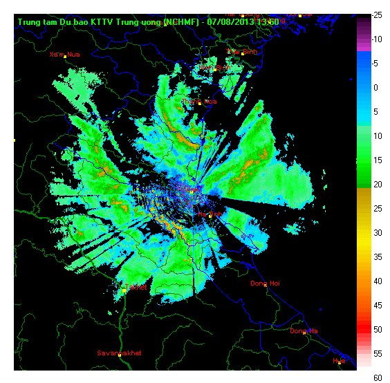
Latest radar out of Vinh (south of Hanoi) shows bands of light to moderate rain impacting the region. The circulation of Mangkhut is somewhat discernible on the radar as well. As much as 150mm of rain is possible tonight along the path of Mangkhut. For the latest radar images and warnings from Vietnam, please click HERE (NCHMF Website).
Tropical Storm Mangkhut will continue pushing inland as it moves northwestward. It should also rapidly weaken as it moves away from the water. Mangkhut is forecast to dissipate as early as tomorrow. However, residual rains from the cyclone could still affect Vietnam and nearby countries for the next two days.
We'll have another update tomorrow morning.
No comments:
Post a Comment