________________________________
Tropical Disturbance 98W has been upgraded into a Tropical Depression by PAGASA and has given a local name of Bagyong Crising. This system was last located approximately 220km south southeast of Davao City or about 180km east of General Santos City. It is currently moving west northwestward at 20kph.
As of 5am this morning, PAGASA has raised Public Storm Warning Signal #1 for Davao del Norte, Davao del Sur, Samal Island, Davao Oriental, Compostela Valley, southern part of Surigao del Sur, Agusan del Sur, Bukidnon, Lanao del Norte, Lanao del Sur, North Cotabato, Maguindanao, Sultan Cudarat, South Cotabato, Sarangani, Misamis Occidental, Zamboanga del Norte, Zamboanga del Sur, and Zamboanga Sibugay.
IR Image from NRLMRY
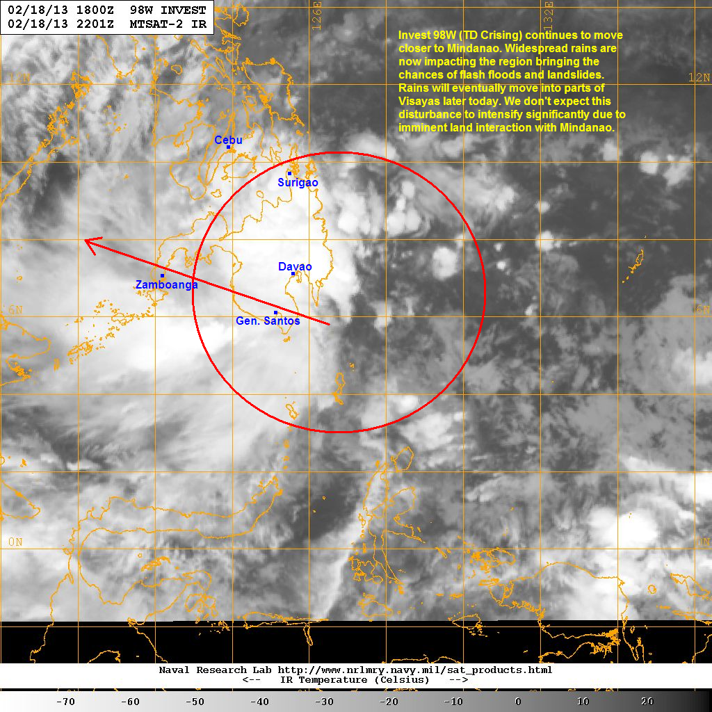
Latest satellite image shows widespread convective activity associated with 98W pushing into Mindanao. This is bringing moderate to sometimes heavy rains in the region with the potential to bring as much as 200mm of rainfall. The chances of flash floods and landslides are high so please coordinate with your local officials!
Cebu Doppler Radar Image (from ClimateX PH)

While much of the rains are currently situated over Mindanao, some of the precipitation will move north into parts of Visayas later today. In fact, the latest radar image out of Cebu (shown above) shows moderate rains moving into the region and are currently impacting Cebu, Bohol, and Leyte. Areas here could receive 50 to even 100mm of rain by tonight. By tomorrow, we expect some light rains to make their way into Southern Luzon as well.
For the latest radar images and rainfall forecast, please click HERE (ClimateX PH).
We'll have another update later this afternoon.
No comments:
Post a Comment