No Public Storm Warning Signals have been posted by PAGASA as of yet.
IR Image from NRLMRY
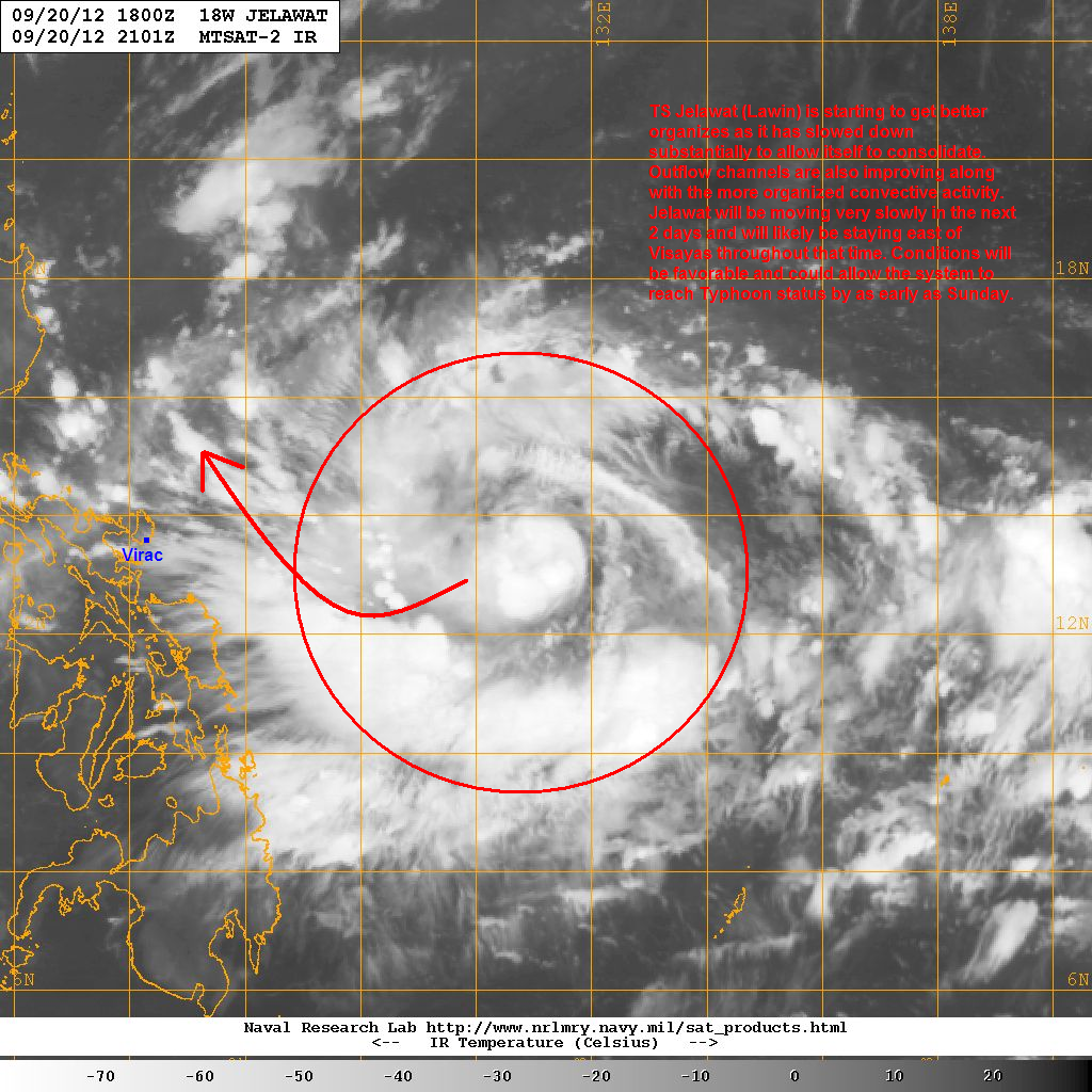
Latest satellite image shows an improving core with more convective activity especially near the center. Outflow channels are also starting to improve especially the equatorward side. Jelawat/Lawin has slowed down considerably allowing itself to consolidate more. It will continue slowing down and will crawl in the next 2 days as it remains east of the Philippines.
No major changes in the forecast tracks. We still expect Jelawat/Lawin to slow down and even stall remaining east of Visayas for at least 2 days. Expect light rain showers to impact Samar and parts of the Bicol Region starting tdoday. Due to the favorable conditions in the Philippine Sea, Jelawat is forecast to steadily intensify and could even become a Typhoon by as early as Saturday night or Sunday morning. It will then start turning to the northwest by Sunday and Monday as the Subtropical Ridge continues to weaken.
For more information on the forecasts for Jelawat, watch our Video Update below (posted yesterday).
We'll have another update later today.
_______________________________________________
Issued (2130 UTC) 530am PhT 092112
No comments:
Post a Comment