Mawar is barely holding on to typhoon status; JMA has actually downgraded it down to a Severe Tropical Storm. We no longer expect strong winds to affect any land areas. Rains, however, will continue for some parts especially now that Mawar is enhancing showers along the stationary boundary. Latest radar image below shows widespread light rains across Southern Kyushu and Shikoku, as well as the prefectures of Wakayama and Mie in Honshu. For more radar images, click HERE (JMA)

IR Image from NRLMRY

The latest radar image above shows Mawar starting to take a more extra-tropical look with its elongated center and cold and dry stratocumulus clouds wrapping in from the southwest. Windfield has also increased with the strongest winds situated on the southeastern periphery.
Typhoon Mawar is forecast to continue weakening and should be downgraded into a tropical storm later tonight. It is forecast to complete extra-tropical transition tomorrow (Wednesday). Mawar will then move well south of Japan, and should pass around 400km south of Tokyo. No stormy effects expected except for occasional rains and rough surf along the coast. The exception here would be the Izu Islands, which are located 280km south of Tokyo, which could see some gusts of up to 80kph tomorrow along with light rains. Conditions should improve for the whole region by Thursday.
Invest 97W
IR Image from NRLMRY
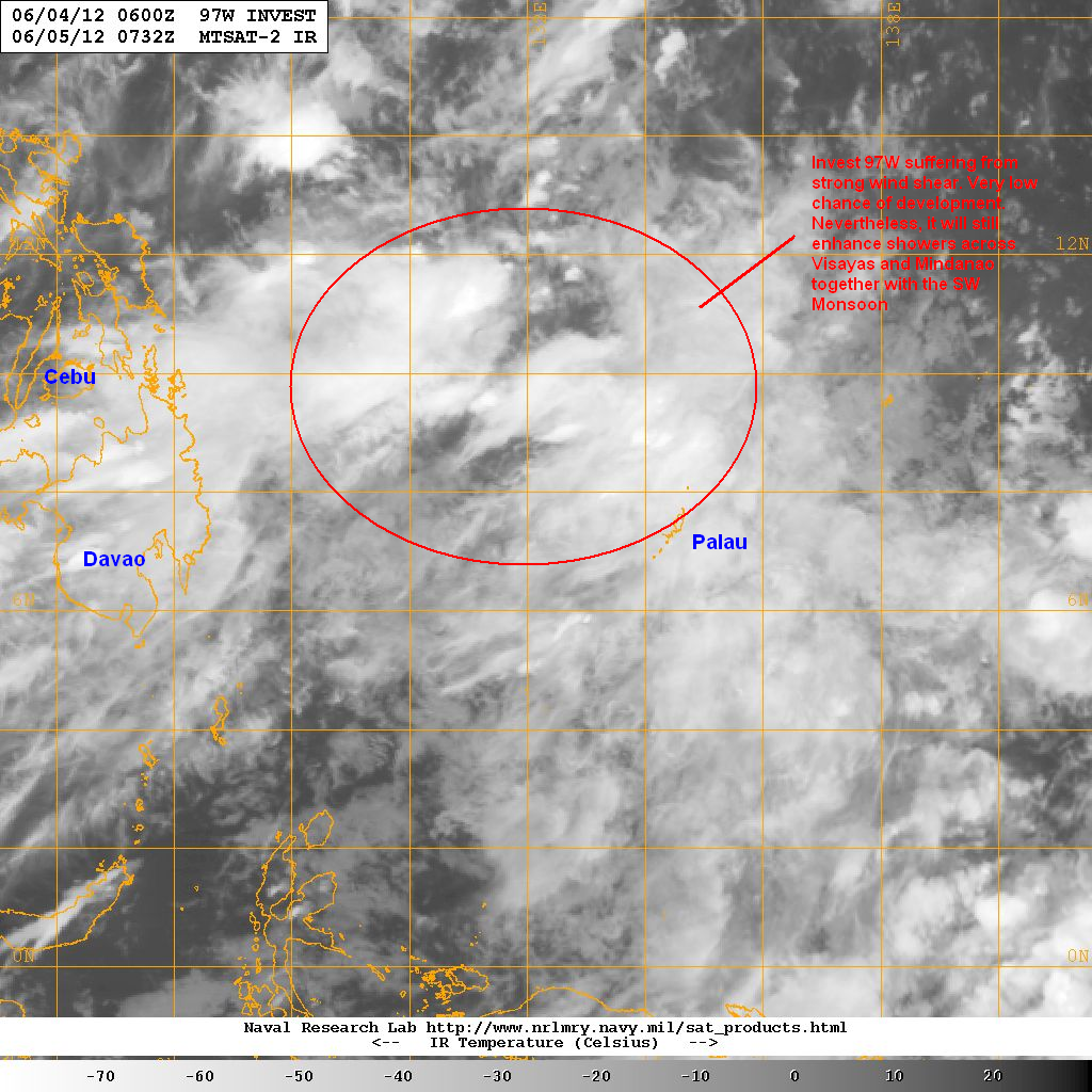
The area of low-pressure which we have been watching all weekend continues to drift east of Mindanao. Invest 97W was last located approximately 450km east of Mindanao. The system has a very low chance of development right now due to the strong wind shear (20 to 30kts) in the region prohibiting the LPA from organizing. Nevertheless, it is still enhancing rain showers across Visayas and Mindanao, and along with the SW Monsoon (even though it is currently subsiding), expect to see some rains of around 50mm in 24 hours to persist. In fact some places in Northern Mindanao saw rainfall amounts of near 100mm in the past 24 hours. Rest of the country will have improving weather with partly to mostly cloudy skies and occasional rains and thunderstorms, especially in the afternoon.
We'll have another update tomorrow morning.
______________________________________________
Issued (0830 UTC) 430pm PhT 060512
No comments:
Post a Comment