PAGASA has now lowered all signal warnings associated with Banyan.
Banyan is struggling to consolidate and re-intensify due to wind shear in the South China Sea which has decreased over the past 6 hours. Agencies are still expecting this to regain Tropical Storm status, though, due to improved conditions in the next 2 days.
Banyan is forecast to continue moving northward due to a weakness in the Ridge but should eventually turn westward as another ridge forms along Southern China. Banyan is expected to track just south of Hainan by Monday and eventually make landfall along Central Vietnam by Tuesday as a weak Tropical Storm.
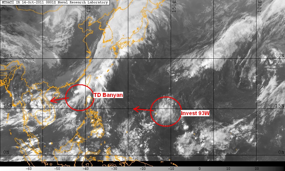
An area of disturbed weather has persisted approximately 300km east of Guam. This LPA, Invest 93W, has a partially exposed and weak low level circulation center. Convection is very weak at the moment but the whole Low Pressure itself is somewhat organized. The disturbance is located in an area of low to moderate wind shear (10-15 kt) and high sea surface temperatures. The system has very little model support with the CMC being the only global model that develops it. Nevertheless, we'll continue to watch the system as it continues to trek westward.
IR Image from NRLMRY
We'll have another update tomorrow.
_______________________________________
Issued (0930 UTC) 530pm PhT 101411
No comments:
Post a Comment