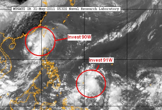
Invest 90W: Located approximately 480km SE of Hong Kong. Convection is largely displaced to the east although some computer models, including the ECMWF, are showing the system to probably intensify into a weak Tropical Depression in the next 24-36 hours. Radar from Taiwan depict heavy rain to the south and southwest. This low pressure is also bringing rain to the western Luzon area particularly Pangasinan, Ilocos, and the Batanes Islands. JTWC is putting out a "Fair" potential for this storm.
If it does become a tropical depression, it will probably remain as a weak system due to the proximity to land (S. China and Taiwan).
Invest 91W: This is more interesting for us due to the favorable conditions in the area. This low pressure was located about 250 ESE of Yap or about 450km ENE of Palau. No computer models are picking up this system just yet although JTWC is putting out a "Poor" confidenct (for the next 24 hours) noting the low vertical wind shear and high sea temperatures.
We will keep watching these two systems over the next few days.
 __________________________________
Issued (0700 UTC) 3pm PhT 053111
No comments:
Post a Comment