________________________________
Please LIKE our Facebook Page for the latest updates!
Watch our latest Video Update below for more in-depth analysis and forecast for Tropical Storm/Typhoon Matmo.
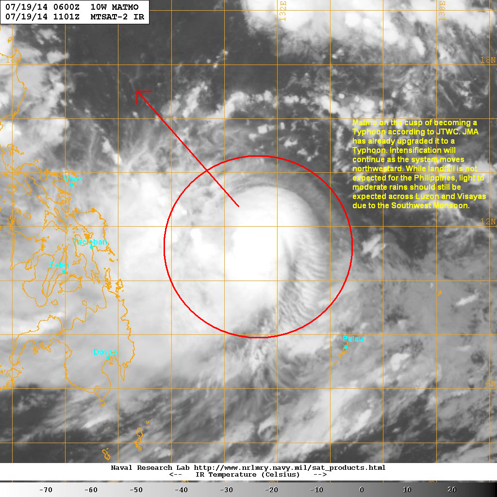
Tropical Storm Matmo (Bagyong Henry) continues to intensify and is now on the cusp of becoming a Typhoon (in fact JMA already upgraded the system to a Typhoon this afternoon). The system as last located approximately 620km northwest of Palau or about 670km east of Tacloban. Maximum sustained winds are at 110kph with gusts of up to 140kph. TS Matmo is currently moving northwestward at 20kph.
As of 5pm this afternoon, PAGASA hasn't issued any Public Storm Warning Signals for the Philippines yet.
IR image from NRLMRY
Latest satellite image shows central convection remains strong with an increasingly symmetrical CDO. An eyewall is also trying to form at the center of Matmo. However, moderate northeasterly wind shear is hampering development and limiting intensification. We expect the environment to become more conducive in the next few days.
Tropical Storm Matmo should become a Typhoon by tomorrow morning and will continue to head northwestward across the Philippine Sea. There is still some uncertainty with the forecast track as some agencies are showing a landfall in Northern Luzon while some in Taiwan. Right now, we urge everyone from Luzon to Taiwan to the Ryukyu Islands in Japan to closely monitor the progress of Matmo.
Another aspect with this cyclone is the enhancement of the Southwest Monsoon (Habagat). We expect rains to spread across Luzon and Visayas over the next few days as Tropical Storm Matmo pulls to the northwest.
We'll have another update tomorrow morning.

No comments:
Post a Comment